


Voting District PB, Currituck County, North Carolina
About
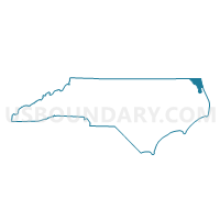
Outline

Summary
| Unique Area Identifier | 639832 |
| Name | Voting District PB |
| County | Currituck County |
| State | North Carolina |
| Area (square miles) | 90.79 |
| Land Area (square miles) | 44.70 |
| Water Area (square miles) | 46.09 |
| % of Land Area | 49.23 |
| % of Water Area | 50.77 |
| Latitude of the Internal Point | 36.28675110 |
| Longtitude of the Internal Point | -75.90780950 |
Maps


Graphs
Select a template below for downloading or customizing gragh for Voting District PB, Currituck County, North Carolina


Neighbors
Neighoring Voting District (by Name) Neighboring Voting District on the Map
- Voting District CB, Currituck County, NC
- Voting District CH, Currituck County, NC
- Voting District CI, Currituck County, NC
- Voting District CJ, Currituck County, NC
- Voting District DUCK, Dare County, NC
- Voting District KI, Currituck County, NC
- Voting District PP, Currituck County, NC
- Voting District SH, Camden County, NC
- Voting District WH, Currituck County, NC
Top 10 Neighboring County Subdivision (by Population) Neighboring County Subdivision on the Map
- Atlantic township, Dare County, NC (17,809)
- Poplar Branch township, Currituck County, NC (7,823)
- Crawford township, Currituck County, NC (7,208)
- Shiloh township, Camden County, NC (2,506)
- Fruitville township, Currituck County, NC (1,637)
Top 10 Neighboring Place (by Population) Neighboring Place on the Map
Top 10 Neighboring Unified School District (by Population) Neighboring Unified School District on the Map
- Dare County Schools, NC (33,920)
- Currituck County Schools, NC (23,547)
- Camden County Schools, NC (9,980)
Top 10 Neighboring State Legislative District Lower Chamber (by Population) Neighboring State Legislative District Lower Chamber on the Map
Top 10 Neighboring State Legislative District Upper Chamber (by Population) Neighboring State Legislative District Upper Chamber on the Map
Top 10 Neighboring 111th Congressional District (by Population) Neighboring 111th Congressional District on the Map
Top 10 Neighboring Census Tract (by Population) Neighboring Census Tract on the Map
- Census Tract 9501.02, Camden County, NC (4,656)
- Census Tract 1103.01, Currituck County, NC (4,243)
- Census Tract 1104.02, Currituck County, NC (3,948)
- Census Tract 9701.01, Dare County, NC (3,675)
- Census Tract 1104.01, Currituck County, NC (3,425)
- Census Tract 1103.02, Currituck County, NC (2,922)
- Census Tract 1101.02, Currituck County, NC (1,545)
- Census Tract 1101.01, Currituck County, NC (542)
Top 10 Neighboring 5-Digit ZIP Code Tabulation Area (by Population) Neighboring 5-Digit ZIP Code Tabulation Area on the Map
- 27949, NC (6,947)
- 27939, NC (2,361)
- 27950, NC (2,006)
- 27974, NC (1,285)
- 27947, NC (1,230)
- 27929, NC (1,166)
- 27966, NC (1,052)
- 27917, NC (833)
- 27916, NC (747)
- 27923, NC (598)